
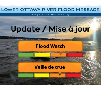
Update #1: Flood Watch - Lower Ottawa River
April 25, 2025 — This FLOOD WATCH statement is an update to the Flood Watch Statement issued for areas along the Lower Ottawa River (Arnprior to Hawkesbury) on April 23rd, 2025.
The Ottawa River Regulation Planning Board (ORRPB) warns that weather events, in particular events bringing increased temperatures and heavy rainfall, may lead to levels and flows exceeding minor flood levels in some locations along the Lower Ottawa River.
Water levels and flows have been gradually increasing along the main stem of the Ottawa River. Levels and flows are expected to continue to increase over the next week due to forecasted rainfall Friday into Saturday, combined with increased spring runoff from snow melt in the northern region of the Ottawa River Basin.
Minor flood levels may be exceeded in flood prone areas along the river between Lake Coulonge and Carillon (Pembroke to Hawkesbury) starting Saturday, April 26. The minor flood level is defined as the level at which parts of some streets, lawns and parks are beginning to flood, with no or few houses/buildings being affected.
This includes flood-prone areas at Lake Coulonge, Chats Lake, Britannia / Lac Deschênes, Pointe-Gatineau, Cumberland, City of Clarence-Rockland, and other vulnerable areas down to Hawkesbury.
There are currently no major flooding indicators of concern and the ORRPB forecasts that levels are expected to peak later next week based on current weather forecasts. Increases in water levels are expected to increase approximately 90 cm at Lake Coulonge to approximately 60 cm at Britannia when compared to levels observed at 4pm on April 24th.
Residents in flood-prone areas are encouraged to closely follow changing conditions and to take necessary measures. Residents are advised to stay away from watercourses where flows are high and where banks might be unstable. Parents are encouraged to explain dangers to children and provide appropriate supervision around all waterbodies.
Residents in flood prone or low-lying areas, historically susceptible to flooding, should take the necessary precautions to protect their property. Please ensure:
- Sump pump is clear, in good working condition and has a backwater valve on it.
- Easy access to portable backup generator and pump.
- Downspouts are clear and the outlet is at least 3 m from the dwelling.
- Driveway culverts are clear of debris and drain well.
- Securing items that might float away as flows increase.
The Mississippi Valley, Rideau Valley, and South Nation Conservation Authorities monitor water levels and weather forecasts with the Ministry of Natural Resources aspart of the Flood Forecasting and Warning Program. Updates are provided as conditions change.
The Ottawa River Regulating Committee will be reassessing forecast conditions and providing hydrological condition updates on its website daily at www.ottawariver.ca/forecasts.
To view current flood warnings across Ontario, visit: www.ontario.ca/law-and-safety/flood-forecasting-and-warning-program.
This FLOOD WATCH STATEMENT is in effect until May 21, 2025 at 5:00 PM.
South Nation Conservation
Kat Watson, Coordinator, Early Warning Systems and Watershed Plans, kwatson@nation.on.ca,1-877-984-2948.
Definitions:
- Water Conditions Statement: Water Safety: indicates that high flows, melting ice or other factors could be dangerous for such users as boaters, anglers, and swimmers but flooding is not expected.
- Water Conditions Statement: Flood Outlook: gives early notice of the potential for flooding based on weather forecasts calling for heavy rain, snow melt, high winds, or other conditions.
- Flood Watch: potential for flooding exists within specific watercourses and municipalities. Municipalities, emergency services and individual landowners in flood-prone areas should prepare.
- Flood Warning: flooding is imminent or occurring within specific watercourses and municipalities.
— end —