
FLOOD WARNING - Lower Ottawa River
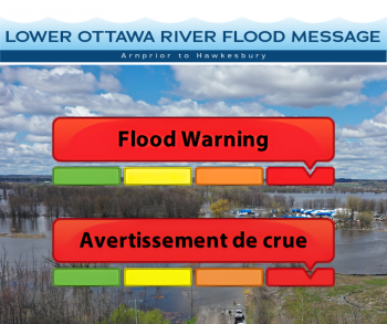
This FLOOD WARNING upgrades the Flood Watch issued April 25, 2025, for areas along the Lower Ottawa River (Arnprior to Hawkesbury).
Water levels and flows have been steadily rising along the Ottawa River due to recent rainfall combined with ongoing snowmelt in the northern basin. Additional increases are expected over the coming days, with further rain and meltwater forecast.
According to the Ottawa River Regulation Secretariat, flood-prone areas from Arnprior to Hawkesbury remain at risk. Current forecasts suggest that water levels on the main Ottawa River will remain
55 - 80 cm below the 2019 historic flood levels, and below 2023 peak levels.
- Pembroke to Britannia: Minor flood levels have been exceeded, with potential for major flooding in some locations starting Friday.
- Gatineau (Hull Marina) to Hawkesbury: Minor flood thresholds have been exceeded; peak levels are expected to stay below major flood limits.
Elevated water levels are forecast to persist beyond May 5, 2025, with an updated statement to follow.
This advisory includes flood-prone locations such as Lake Coulonge, Chats Lake, Britannia / Lac Deschênes, Pointe-Gatineau, Cumberland, Clarence-Rockland, and Hawkesbury.
Area-Specific Forecasts:
Mississippi Valley Conservation Authority (MVCA):
Constance Bay: Water levels expected to rise ~25 cm by weekend. This remains about 35 cm below the 2023 peak. Flooding of low-lying properties, roads, and shoreline structures is possible. Residents should monitor shoreline conditions and prepare accordingly.
Rideau Valley Conservation Authority (RVCA):
Britannia (Grandview Rd, Belltown Community): Expected rise of ~30 cm by weekend, about 15 cm below 2023 levels. Low-lying yards, parks, and roads may experience localized flooding.
East of Cumberland Village (Boisé Village, Morin Rd, Léo Lane): Anticipated rise of ~25 cm by weekend, ~75 cm below 2023 peaks. Potential access issues along Boisé Lane; residents should prepare for restricted road access.
South Nation Conservation (SNC):
Clarence-Rockland (Voisine Road and Old Highway 17): Forecasted increase of ~30 cm by weekend, ~35 cm below 2023 levels. Low-lying areas near the river and some municipal roads may experience water on the roadway; residents should secure property and monitor updates.
Ministry of Natural Resources (MNR):
Hawkesbury: Expected rise of ~20 cm by weekend, ~25 cm below 2023 peaks. Shoreline properties, parks, and some access roads could be affected.
Note: Forecasted increases are relative to water levels measured as of 8:00 a.m., May 1, 2025. These projections depend on the rate of remaining snowmelt in the Upper Ottawa River Watershed and the amount of rainfall received over the coming days.
Residents in flood prone or low-lying areas, historically susceptible to flooding, should take the necessary precautions to protect their property. Please ensure:
- Sump pump is clear, in good working condition and has a backwater valve on it.
- Easy access to portable backup generator and pump.
- Downspouts are clear and the outlet is at least 3 m from the dwelling.
- Driveway culverts are clear of debris and drain well.
- Securing items that might float away as flows increase.
Additional Information
The Mississippi Valley, Rideau Valley, and South Nation Conservation Authorities
continue to monitor conditions alongside the Ministry of Natural Resources and under
Ontario’s Flood Forecasting and Warning Program. Updates are provided as conditions change.
For current Ottawa River conditions and forecasts, visit:
https://ottawariver.ca/conditions/
For provincial flood warnings, visit:
www.ontario.ca/law-and-safety/flood-forecasting-and-warning-program
This FLOOD WARNING is in effect until May 5, 2025, at 5:00 PM.
South Nation Conservation
Kat Watson, Coordinator, Early Warning Systems and Watershed Plans
kwatson@nation.on.ca | 1-877-984-2948
Definitions:
- Water Conditions Statement: Water Safety: indicates that high flows, melting ice or other factors could be dangerous for such users as boaters, anglers, and swimmers but flooding is not expected.
- Water Conditions Statement: Flood Outlook: gives early notice of the potential for flooding based on weather forecasts calling for heavy rain, snow melt, high winds, or other conditions.
- Flood Watch: potential for flooding exists within specific watercourses and municipalities. Municipalities, emergency services and individual landowners in flood-prone areas should prepare.
- Flood Warning: flooding is imminent or occurring within specific watercourses and municipalities.
— end —